Download
Articles in journals
- Snopková, D., Švedová, H.,; Kubíček, P., Stachoň, Z. (2019). Navigation in Indoor Environments: Does the Type of Visual Learning Stimulus Matter? ISPRS International Journal of Geo-Information, 8(6), pp. 1-26. ISSN 2220-9964.
- Šašinka, Č., Stachoň, Z., Sedlák, M., Chmelík, J., Herman, L., Kubíček, P., Šašinková, A., Doležal, M., Tejkl, H., Urbánek, T., Svatoňová, H., Ugwitz, P., Juřík, V. (2019): Collaborative Immersive Virtual Environments for Education in Geography. ISPRS International Journal of Geo-Information, 8(1), pp. 1-25. ISSN 2220-9964.
- Stachoň, Z., Šašinka, Č., Čeněk, J., Angsuesser, S., Kubíček, P., Štěrba, Z., Bilíková, M. (2018): Effect of Size, Shape and Map Background in Cartographic Visualization: Experimental Study on Czech and Chinese Populations. ISPRS International Journal of Geo-Information, 7(11), pp. 1-15. ISSN 2220-9964.
- Herman, L., Juřík, V., Stachoň, Z., Vrbík, D., Russnák, J., Řezník, T. (2018): Evaluation of User Performance in Interactive and Static 3D Maps. ISPRS International Journal of Geo-Information, 7(11), pp. 1-25. ISSN 2220-9964.
- Herman, L., Řezník, T., Stachoň, Z., Russnák, J. (2018): The Design and Testing of 3DmoveR: an Experimental Tool for Usability Studies of Interactive 3D Maps. Cartographic Perspectives, 2018(90), pp. 31-63. ISSN 1048-9053.
- Stachoň, Z., Šašinka, Č., Čeněk, J., Štěrba, Z., Angsuesser, S., Fabrikant, S. I., Štampach, R., Morong, K. (2018): Cross-cultural Differences in Figure–ground Perception of Cartographic Stimuli. Cartography and Geographic Information Science. ISSN 1523-0406
- Šašinka, Č., Stachoň, Z., Kubíček, P., Tamm, S., Matas, A., Kukaňová, M. (2018): The Impact of Global/Local Bias on Task-solving in Map-related Tasks Employing Extrinsic and Intrinsic Visualization of Risk Uncertainty Maps. Cartographic Journal. ISSN 0008-7041.
- Šašinka, Č., Morong, K., Stachoň, Z. (2017): The Hypothesis Platform: An Online Tool for Experimental Research into Work with Maps and Behavior in Electronic Environments. ISPRS International Journal of Geo-Information, 6(12), pp. 1-22. ISSN 2220-9964.
- Kubíček, P., Šašinka, Č., Stachoň, Z., Herman, L., Juřík, V., Urbánek, T., Chmelík, J. (2017): Identification of Altitude Profiles in 3D Geovisualizations: the Role of Interaction and Spatial Abilities. International Journal of Digital Earth, pp. 1-18. ISSN: 1753-8955.
- Svatoňová, H., Kolejka, J. (2017): Comparative Research of Visual Interpretation of Aerial Images and Topographic Maps for Unskilled Users: Searching for Objects Important for Decision-Making in Crisis Situations. ISPRS International Journal of Geo-Information, 6(8), pp. 1-18. ISSN 2220-9964.
- Herman, L., Popelka, S., Hejlová, V. (2017): Eye-tracking Analysis of Interactive 3D Geovisualization. Journal of Eye Movement Research, 10(3), pp. 1-15. ISSN 1995-8692.
- Juřík, V., Herman, L., Šašinka, Č., Stachoň, Z., Chmelík, J. (2017): When the Display Matters: A Multifaceted Perspective on 3D Geovisualizations. Open Geosciences, 9(1), pp. 89-100. ISSN 2391-5447.
- Popelka, S., Stachoň, Z., Šašinka, Č., Doleželová, J. (2016): Eyetribe Tracker Data Accuracy Evaluation and Its Interconnection with Hypothesis Software for Cartographic Purposes. Computational Intelligence and Neuroscience, 2016, pp. 1-14. ISSN 1687-5265.
Conference proceedings and book chapters
- Herman, L. Kvarda, O., Stachoň, Z. (2018): Cheap and Immersive Virtual Reality: Application in Cartography. In Zlatanova, S., Dragicevic, S., Sithole, G. (eds.) ISPRS Archives of the Photogrammetry, Remote Sensing and Spatial Information Sciences, Vol. XLII-4. Gottingen: Copernicus GmbH. pp. 261-266. ISSN 1682-1750.
- Snopková, D., Juřík, V. (2018): User Aspects of Navigation in Virtual Environments. In Spatial Cognition Conference 2018. Tubingen.
- Herman, L., Stachoň, Z. (2018): Controlling 3D Geovisualizations on Touch Screen – The Role of Users Age and Gestures Intuitiveness. In Bandrova T., Konečný M. (eds.) Proceedings, 7th International Conference on Cartography and GIS, Vol. 1. Sofia: Bulgarian Cartographic Association. pp. 473-480. ISSN 1314-0604.
- Juřík, V., Herman, L., Šašinka, Č., Stachoň, Z., Chmelík, J., Strnadová, A., Kubíček, P. (2018): Behavior Analysis in Virtual Geovisualizations: Towards Ecological Validity. In Bandrova T., Konečný M. (eds.) Proceedings, 7th International Conference on Cartography and GIS, Vol. 1. Sofia: Bulgarian Cartographic Association. pp. 518-527. ISSN 1314-0604.
- Stachoň, Z., Kubíček, P., Málek, F., Krejčí, M, Herman, L. (2018): The Role of Hue and Realism in Virtual Reality. In Bandrova T., Konečný M. (eds.) Proceedings, 7th International Conference on Cartography and GIS, Vol. 2. Sofia: Bulgarian Cartographic Association. pp. 932-941. ISSN 1314-0604.
- Ugwitz, V., Stachoň, Z. (2018): Visual Elements in Virtual Environments: Finding Parallels between CGI Visualizations and Human Perception. In Bandrova T., Konečný M. (eds.) Proceedings, 7th International Conference on Cartography and GIS, Vol. 1. Sofia: Bulgarian Cartographic Association. pp. 500-5006. ISSN 1314-0604.
- Juřík, V., Herman, L., Šašinka, Č. (2018): Interaction Primitives in 3D Geovisualizations. In Svobodová, H. (ed.) Useful Geography: Transfer from Research to Practice. Proceedings of 25th Central European Conference. Brno: Masaryk University, pp. 294-303. ISBN 978-80-210-8908-2.
- Herman, L., Russnák, J., Stuchlík, R., Hladík, J. (2018): Visualization of Traffic Offences in the City of Brno (Czech Republic): Achieving 3D Thematic Cartography through Open Source and Open Data. In Svobodová, H. (ed.) Useful Geography: Transfer from Research to Practice. Proceedings of 25th Central European Conference. Brno: Masaryk University, pp. 270-280. ISBN 978-80-210-8908-2.
- Chmelík, J., Jurda, M. (2017): VEAAR – Virtual Environment for Archaeological Artefacts Restoration. In Spencer, S. N. (ed.) Proceedings of the ACM Symposium on Virtual Reality Software and Technology. Gothenburg; Sweden: Association for Computing Machinery.
- Svatoňová, H., Šikl, R. (2017): Cognitive Aspects of Interpretation of Image Data. In Hošková-Mayerová Š., Maturo F., Kacprzyk J. (eds.) Mathematical-Statistical Models and Qualitative Theories for Economic and Social Sciences. Cham: Springer. pp. 161-175. ISBN 978-3-319-54818-0.
- Doležal, M., Chmelík, J., Liarokapis, F. (2017): An Immersive Virtual Environment for Collaborative Geovisualization. In 9th International Conference on Virtual Worlds and Games for Serious Applications (VS-Games 2017). Athens, Greece: IEEE Computer Society. pp. 272-275. ISSN 2474-0489.
- Herman, L., Russnák, J., Řezník, T. (2017): Flood Modelling and Visualizations of Floods through 3D Open Data. In Schimak G.,Pitner T.,Denzer R.,Hrebicek J. (eds.) Environmental Software Systems. Computer Science for Environmental Protection. Heidelberg: Springer International Publishing, 2017. pp. 139-149. ISBN 978-3-319-89934-3.
- Chmelařová, K., Šašinka, Č., Stachoň, Z. (2017): Visualization of Environment-related Information in Augmented Reality: Analysis of User Needs. In Peterson M. (eds.) Advances in Cartography and GIScience, ICACI 2017. Cham: Springer. pp. 283-292. ISBN 978-3-319-57335-9.
- Ugwitz, P., Juřík, V., Šašinka, Č. (2017): Visual Cognitive Styles in Virtual Environments: Constructing and Evaluating Adequate Tasks. In Farkaš, I. et al. Kognicia a umelý život XVII, 2017. Bratislava, Slovakia: Univerzita Komenského v Bratislave. pp. 184-189. ISBN 978-80-223-4346-6.
- Juřík, V., Ugwitz, P., Šašinka, Č. (2017): Primitiva virtuální interakce: základní stavební kameny pro vývoj a výzkum interaktivních virtuálních prostředí [in czech]. In Farkaš, I. et al. Kognicia a umelý život XVII, 2017. Bratislava, Slovakia: Univerzita Komenského v Bratislave. pp. 81-86. ISBN 978-80-223-4346-6.
- Herman, L., Stachoň, Z., Stuchlík, R., Hladík, J., Kubíček, P. (2016): Touch Interaction with 3D Geographical Visualization on Web: Selected Technological and User Issues. In Dimopoulou, E., van Oosterom, P. ISPRS Archives of the Photogrammetry, Remote Sensing and Spatial Information Sciences, Vol. XLII-2/W2. Athens, Greece: Copernicus GmbH. pp. 33-40. ISSN 1682-1750.
- Svatoňová, H. (2016): Analysis of Visual Interpretation of Satellite Data. In Halounova, L. et al. ISPRS Archives of the Photogrammetry, Remote Sensing and Spatial Information Sciences, Vol. XLI-B2. Prague, Czech Republic: Copernicus GmbH. pp. 675-681. ISSN 1682-1750.
- Juřík, V., Herman, L., Kubíček, P., Stachoň, Z., Šašinka, Č. (2016): Cognitive Aspects of Collaboration in 3D Virtual Environments. In Halounova, L. et al. ISPRS Archives of the Photogrammetry, Remote Sensing and Spatial Information Sciences, Vol. XLI-B2. Prague, Czech Republic: Copernicus GmbH. pp. 663-670. ISSN 1682-1750.
- Herman, L., Stachoň Z. (2016): Comparison of User Performance with Interactive and Static 3D Visualization – Pilot Study. In Halounova, L. et al. ISPRS Archives of the Photogrammetry, Remote Sensing and Spatial Information Sciences, Vol. XLI-B2. Prague, Czech Republic: Copernicus GmbH. pp. 655-661. ISSN 1682-1750.
- Juřík, V., Šašinka, Č. (2016): Learning in Virtual 3D Environments: All About Immersive 3D Interfaces. In Chova, L. G. et al. 8th International Conference on Education and New Learning Technologies (EDULEARN). Barcelona, Spain: IATED. pp. 7868-7881. ISSN 2340-1117.
Presentations
- Herman, L. (2018): Cheap and Immersive Virtual Reality: Application in Cartography. ISPRS TC IV Mid-term Symposium ‘3D Spatial Information Science – The Engine of Change’. Delft, Netherlands.
- Snopková, D. (2018): Introducing the ColorADD Color Coding System in Map Design. ICA Commisions Joint Workshop – Atlases, Cognition, Usability. Olomouc, Czech Republic.
- Herman, L. (2018): How Deal with User Interaction in 3D Geovisualizations?. ICA Commisions Joint Workshop – Atlases, Cognition, Usability. Olomouc, Czech Republic.
- Kubíček, P. (2018): Aspekty ovlivňující využití 3D vizualizace [in czech]. Cartographic Day. Olomouc, Czech Republic.
- Juřík, V., Snopková, D. (2018): Uživatelské úlohy a 3D vizualizace [in czech]. Cartographic Day. Olomouc, Czech Republic.
- Stachoň, Z., Ugwitz, P. (2018): Geovizualizace ve virtuální realitě – role interakce [in czech]. Cartographic Day. Olomouc, Czech Republic.
- Stuchlík, R. et al. (2017): Utilization of Virtual Reality for Teaching 3D Tasks in Geography. IGU – CGE Lisbon Symposium: Integrating Knowledge and Understanding in Geography Education. Lisbon, Portugal.
- Herman, L., Juřík, V., et al. (2017): Virtuální realita v kartografii – použitelnost, interaktivita a jejich testování [in czech]. 22. Kartografická konference. Liberec, Czech Republic.
- Kubíček, P., Stachoň, Z., et al. (2017): Vybrané uživatelské aspekty trojrozměrné vizualizace [in czech]. 22. Kartografická konference. Liberec, Czech Republic
- Chmelařová, K., Šašinka, Č., Stachoň, Z. (2017): Visualization of Environment-related Information in Augmented Reality: Analysis of User Needs. 28th International Cartographic Conference. Washington, USA.
- Stachoň, Z., et al. (2017): The Complex Tasks with 3D Cartographic Visualization – The Role of Immersion and Interactivity. 28th International Cartographic Conference. Washington, USA.
- Herman, L., et al. (2016): Touch Interaction with 3D Geographical Visualization on Web: Selected Technological and User Issues. 3D GeoInfo Conference. Athens, Greece.
- Stachoň, Z., et al. (2016): Uživatelská specifika 3D vizualizací [in czech]. Výroční sjezd České geografické společnosti. České Budějovice, Czech Republic.
- Juřík, V., Herman, L., et al. (2016): Cognitive Aspects of Collaboration in 3D Virtual Environments. ISPRS Congres. Prague, Czech Republic.
- Juřík, V. (2016): Learning in Virtual 3D Environments: All about Immersive Virtual 3D Interfaces. EDULEARN. Barcelona, Spain.
- Juřík, V. (2016): 3D Visualization of Geographical Data. Kognice a umělý život. Telč, Czech Republic.
- Stachoň, Z., Kubíček, P., et al. (2016): Interactive 3D Visualiation and Geospatial Data Depiction. AAG Annual Meeting. San Francisco, USA.
Posters
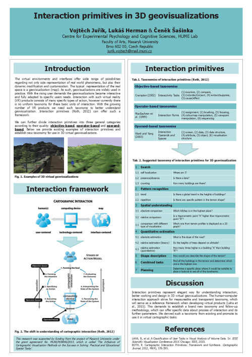
- Juřík, V., et al. (2017): Interaction primitives in 3D geovisualizations. 25. středoevropská geografická konference. Užitečná geografie: přenos z výzkumu do praxe. Brno, Czech Republic.
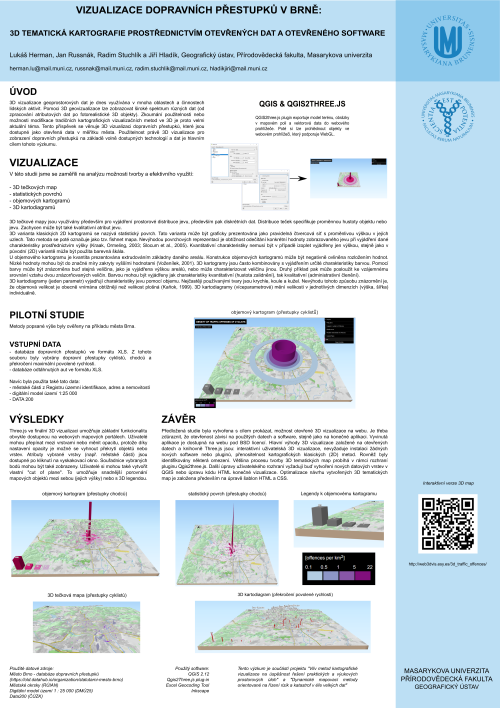
- Herman, L., et al. (2017): Vizualizace dopravních přestupků v Brně: 3D tematická kartografie prostřednictvím otevřených dat a otevřeného software [in czech]. 25. středoevropská geografická konference. Užitečná geografie: přenos z výzkumu do praxe. Brno, Czech Republic.
- Juřík, V., et al. (2017): Information Availability: The Influence of the User Interface on Spatial Awareness in Virtual Geovisualizations. 28th International Cartographic Conference. Washington, USA.
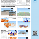
- Herman, L., Řezník, T., Stachoň, Z. (2017): Achieving 3D Thematic Cartography through Open Source: Synergy of QGIS and Three.js. 28th International Cartographic Conference. Washington, USA.
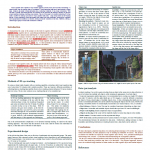
- Ugwitz, P., Juřík, V., Šašinka, Č. (2017): Visual Cognitive Styles in Virtual Environments: Constructing and Evaluating Adequate Tasks. Kognicia a umelý život XVII, 2017. Bratislava, Slovakia.
- Juřík, V. et al. (2016): Embodied Morality: TheInfluence of Body on Moral Judgement. Sociální procesy a osobnost. Nový Smokovec, Slovakia.
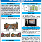
- Herman, L., Stachoň Z. (2016): Comparison of User Performance with Interactive and Static 3D Visualization – Pilot Study. ISPRS Congres. Prague, Czech Republic.
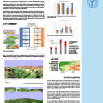
- Juřík V. (2016): Is More Less? How 3D Visualization Affects Cognition. 90th anniversary of the Deparment of Psychology FF MU. Brno, Czech Republic.
