
Two papers published in ISPRS International Journal of Geo-Information
1 November 2018
 Papers “Evaluation of User Performance in Interactive and Static 3D Maps” and “Effect of Size, Shape and Map Background in Cartographic Visualization: Experimental Study on Czech and Chinese Populations” were published in open acces journal ISPRS International Journal of Geo-Information (indexed in Scopus and WoS, IF 1.723)
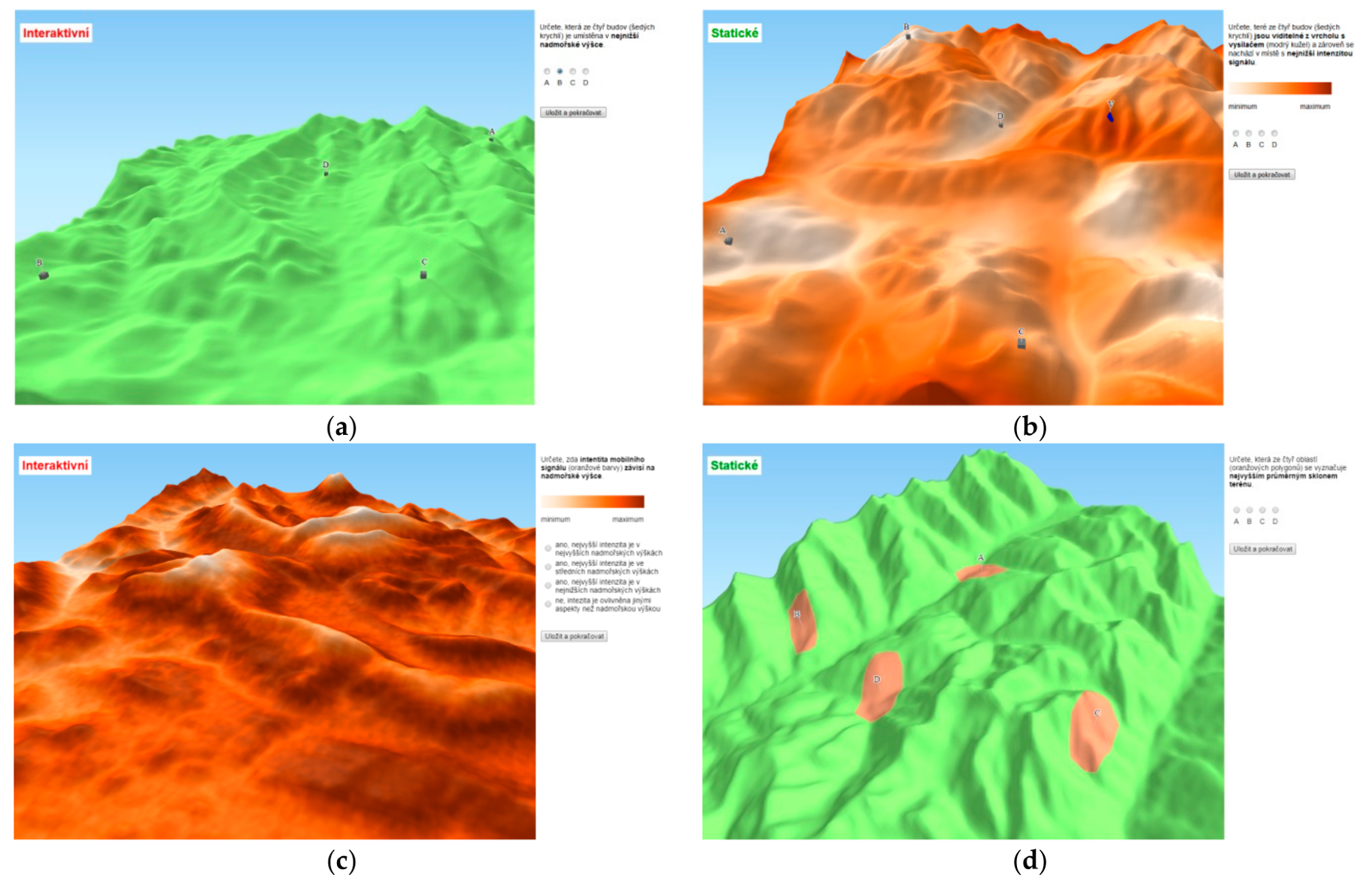
Paper “Evaluation of User Performance in Interactive and Static 3D Maps” belongs to the special issue “Cognitive Aspects of Human-Computer Interaction for GIS“. The main objective of this paper was to identify differences between interactive and static 3D maps. We also explored the role of different tasks and inter-individual differences of map users. In the experimental study, effectiveness, efficiency, and subjective preferences, when working with static and interactive 3D maps, were analyzed.
 Second paper called “Effect of Size, Shape and Map Background in Cartographic Visualization: Experimental Study on Czech and Chinese Populations” deals with the issue of the perceptual aspects of selected graphic variables and map background in cartographic visualization. The results bring a new perspective on the usage of shape, size and presence/absence of background as graphic variables, as well as a comparison to previous studies.
ISPRS Technical Commission IV Mid-term Symposium
8 October 2018; Delft, Netherlands
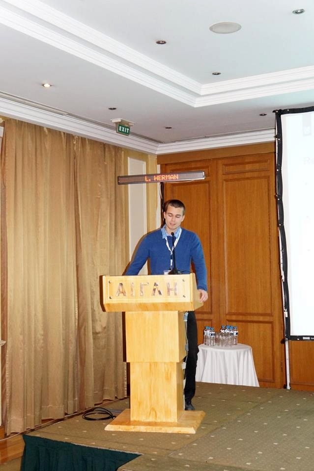
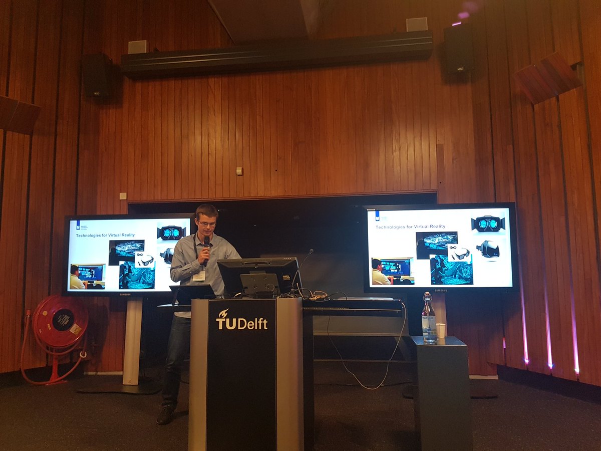 ISPRS Technical Commission IV Mid-term Symposium named ‘3D Spatial Information Science – The Engine of Change’ took place in Delft, Netherlands from Monday 1 to Friday 5 October 2018. Symposium took place simultaneously with 3D conferences 13th 3D Geo Info Conference, 6th International FIG Workshop on 3D Cadastres and 3rd International Conference on Smart Data and Smart Cities. Carto4edu team was represented here RNDr. Lukáš Herman. He participate actively in workshop “Theme session on Virtual & Augmented Reality: Technology, Design & Human Factors” (more information here) and had also regular oral presentation named “Cheap and Immersive Virtual Reality: Application in Cartography“. Paper with same name was also published in the conference proceedings (ISPRS Archives).
Spatial Cognition Conference
12 September 2018; Tubingen, Germany
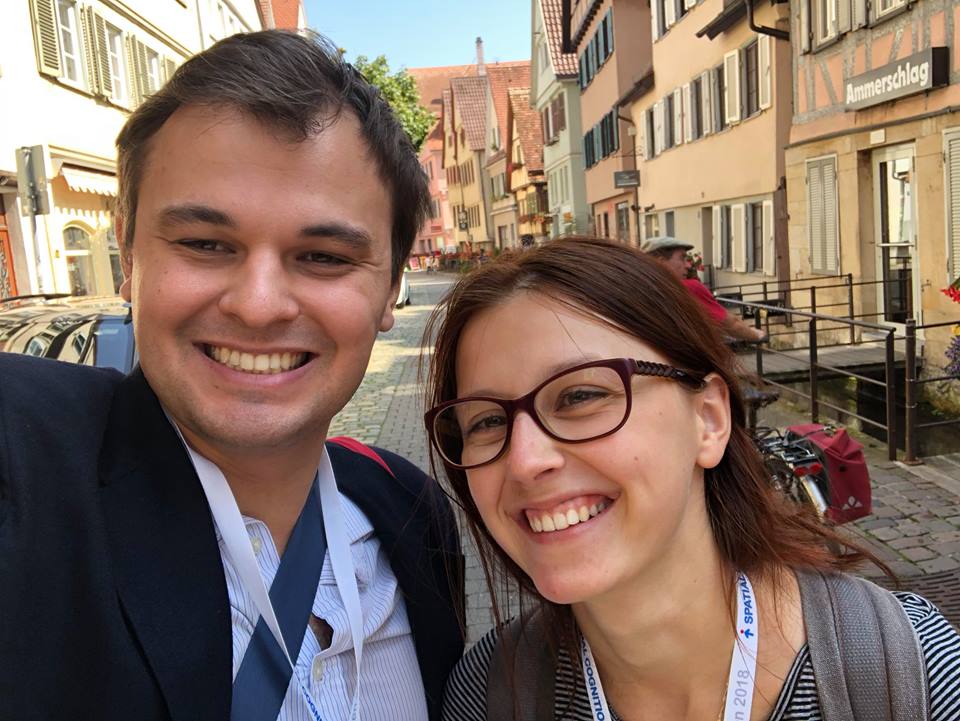 International conference Spatial Cognition 2018 took place in Tubingen, Germany, from Wednesday 5. to Saturday 8. September 2018. The conference was focused on the issue of spatial cognition from psychologists’, biologists’, cartographers’ and IT experts’ point of view, i.e. the main message of the conference was about discussing the spatial cognition from various scientific perspectives and deepening interdisciplinary common tongue among researchers. The topic of virtual reality and other modern technologies used in research of spatial cognition were greatly represented here. Regarding the attendance, Carto4edu team was represented by MSc. Dajana Snopková and MSc. Vojtěch Juřík, who both actively participated on the program of the conference with their contribution “User Aspects of Navigation in Virtual Environments“. The extended abstract of this contribution you can find here.
Paper published in Cartographic Perspectives
2 October 2018
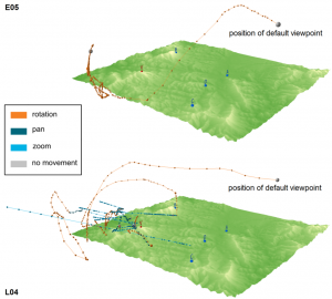 Paper “The Design and Testing of 3DmoveR: an Experimental Tool for Usability Studies of Interactive 3D Maps” has been published in journal Cartographic Perspectives (indexed in Scopus). This paper describes design, development, verification and pilot application of testing software tool 3DmoveR (3D Movement and Interaction Recorder). Its design incorporates findings from the latest 3D visualization research and it is implemented using open web technologies. Pilot application of 3DmoveR revealed differences between laypersons and experts (cartographers) when working with interactive 3D maps. The 3DmoveR facilitates observing and understanding of user behaviours in 3D environments.
7th International Conference on Cartography & GIS
27 June 2018; Sozopol, Bulgaria
 7th International Conference on Cartography & GIS took place in Sozopol, Bulgaria, from Monday 18 to Saturday 23 June 2018 (conference web page). Conference was organized by International Cartographic Association, Bulgarian Cartographic Association and University of Architecture, Civil Engineering and Geodesy. Carto4edu team was represented here by Assoc. Prof. RNDr. Petr Kubíček, PhD., MSc. BSc. Zdeněk Stachoň, Ph.D., Msc. Vojtěch Juřík and Msc. Pavel Ugwitz. They gave four oral presentations and Petr Kubíček and Zdeněk Stachoň were also chairmen of conference sections.
 Zdeněk Stachoň had two presentations: ‘The Role of Hue and Realism in Virtual Reality’ and ‘Controlling 3D Geovisualizations on Touch Screen – The Role of Users Age and Gestures Intuitiveness’. Vojtěch Juřík performed with a presentation ‘Behavior Analysis in Virtual Geovisualizations: Towards Ecological Validity’ and Pavel Ugwitz presented the theme ‘Visual Elements in Virtual Environments: Finding Parallels between CGI Visualizations and Human Perception’. Papers with same name were also published in the conference proceedings.
Paper accepted and published online
22 May 2018
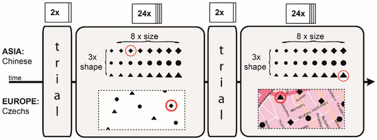
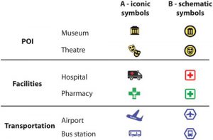 Paper “Cross-cultural differences in figure–ground perception of cartographic stimuli” has been accepted in journal Cartography and Geographic Information Science (indexed in Scopus and WoS, IF 2.391). This paper reports on an empirical study investigating cultural differences in the visuospatial perception and cognition of qualitative point symbols shown on reference maps. Two informationally equivalent symbol sets were developed, depicted on identical reference maps and shown to Czech and Chinese map readers. Empirical results suggest the existence of cultural influences on map reading, but not in the predicted direction based on the previous cross-cultural studies.
SPRING – ICA Commisions Joint Workshop
27-30 April 2018; Olomouc, Czech Republic
 Joint Workshop took place in Olomouc from Friday 27 to Monday 30 April and it was organized, by the ICA Commission on Atlases in cooperation with the ICA Commission on Cognitive Issues in Geographic Information Visualization and the ICA Commission on Use, User and Usability Issues (for more information see workshop web page). Carto4edu team was represented here by Assoc. Prof. RNDr. Petr Kubíček, PhD., MSc. BSc. Zdeněk Stachoň, Ph.D., RNDr. Lukáš Herman and BSc. Dajana Snopková. Members of the project team took part in a Friday program, including the “Introduction to Reproducibility in Social Sciences” workshop and a discussion on “The reproducibility ‘crisis’ in science: Is it relevant for cartographers?”. On Saturday and Sunday there were classical presentations. Dajana Snopková presented the theme “Introducing the ColorADD color coding system in map design” and Lukáš Herman performed with a presentation “How deal with user interaction in 3D geovisualizations?“.
Series of presentations on the “Cartographic Day” in Olomouc
27 February 2018; Olomouc, Czech Republic
 On Friday, 23rd February 2018, cartographers from Czech Republic and Slovakia met in the annual Cartographic Day event, which was focused on 3D visualization in cartography. Carto4edu research team was represented by Assoc. Prof. RNDr. Petr Kubíček, PhD., MSc. BSc. Zdeněk Stachoň, Ph.D., MSc. Vojtěch Juřík, MSc. BSc. Pavel Ugwitz and BSc. Dajana Snopková. The members of the project team gave three presentations fucusing on research in the area of perception and understanding of 3D visualization and the suitability of deploying this current form of visualization for cartographic tasks. Petr Kubíček gave an introduction by presentation “Aspects Affecting the Use of 3D Visualization“, Vojtěch Juřík and Dajana Snopková focused on “User Tasks and 3D Visualization“, Zdeněk Stachoň and Pavel Ugwitz concentrate on “Geovisualization in Virtual Reality – the Role of Interaction“. More information and photos are available on the conference website and in the online magazine GISportal.cz.
Paper accepted
12 February 2018
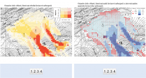 Paper “The Impact of Global/Local Bias on Task-solving in Map-related Tasks Employing Extrinsic and Intrinsic Visualization of Risk Uncertainty Maps” has been accepted in Cartographic Journal (indexed in Scopus and WoS, IF 0.772). This paper compares users strategies employed when solving practical tasks with different variants of avalanche hazard maps.
Another article published
20 December 2017
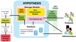
Paper “The Hypothesis Platform: An Online Tool for Experimental Research into Work with Maps and Behavior in Electronic Environments” was published in open acces journal ISPRS International Journal of Geo-Information (indexed in Scopus and WoS, IF 1.502). This article presents a testing platform called Hypothesis. This software was developed for experimental research in cartography and psychological diagnostics. Hypothesis software development is one of the promised outputs of this project.
IGU – CGE Lisbon Symposium: Integrating Knowledge and Understanding in Geography Education
25 – 28 October 2017; Lisbon, Portugal
IGU – CGE Lisbon Symposium: Integrating Knowledge and Understanding in Geography Education was held in Lisbon at Instituto de Geografia e Ordenamanto do Território, Universidade de Lisboa. The main programme of this symposium took place at two days. There were more than 50 presenters from all over the world. Conferrence’s programme was divided into three concurrent session. MSc. Radim Stuchlík had presentation about Utilization of Virtual Reality for Teaching 3D Tasks in Geography.
25th Central European Geographic Conference
12 -13 October 2017; Brno, Czech Republic
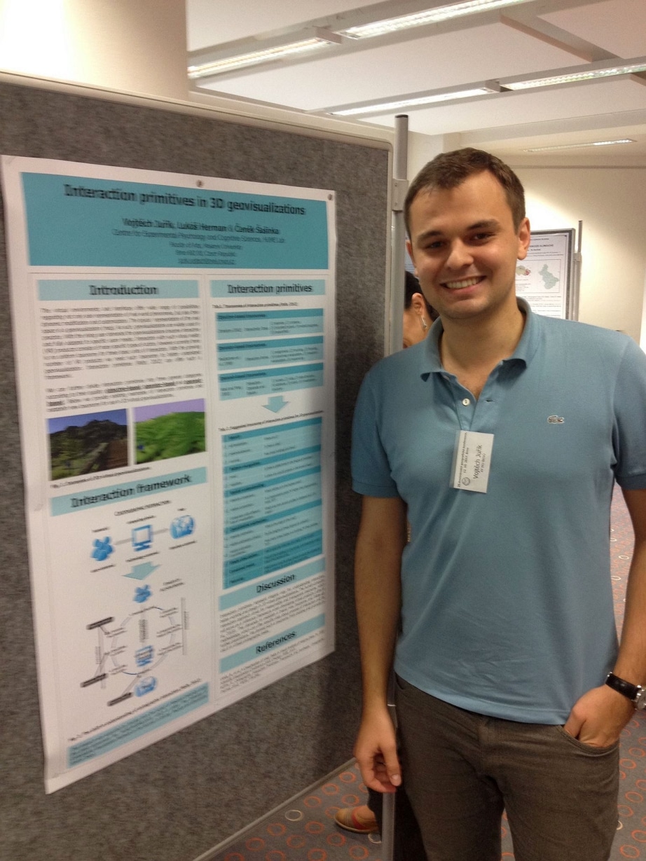 25th Czech Cartographic Conference took place in mid-October in the Brno at the Faculty of Education. The program comprised one plenary session, three parallel panel sessions and a poster section. Carto4edu research team was represented by MSc. Vojtěch Juřík and RNDr. Lukáš Herman. They presented two posters: “Interaction Primitives in 3D Geovisualizations” and “Visualization of Traffic Offences in the City of Brno (Czech Republic): Achieving 3D Thematic Cartography through Open Source and Open Data“.
Article published on-line in International Journal of Digital Earth
19 September 2017, updated 4 October 2017
Paper “Identification of Altitude Profiles in 3D Geovisualizations: The Role of Interaction and Spatial Abilities” (doi:10.1080/17538947.2017.1382581) has been accepted and published on-line in journal International Journal of Digital Earth, which is indexed in Scopus and WoS databases and has IF 2.978 (Q2). Our article is assigned to a special number “Human-Centered Virtual and Augmented Reality Geovisualization Environments”. A large part of the project team (Petr Kubíček, Čeněk Šašinka, Zdeněk Stachoň, Lukáš Herman, Vojtěch Juřík, Tomáš Urbánek and Jiří Chmelík) was involved in the article. Procedure of the experiment described in our article is documented in the video below.
22th Cartographic Conference
6 – 8 September 2017; Liberec, Czech Republic
 22th Czech Cartographic Conference was held in early September in the Liberec and involved more than 80 participants. The program comprised of 6 workhshops and 35 presentation. The research team Carto4edu was represented by MSc. BSc. Zdeněk Stachoň, Ph.D., RNDr. Lukáš Herman and Assoc. Prof. RNDr. Petr Kubíček, PhD. Lukáš Herman gave an oral presentation on the “Virtual Reality and Cartography – interactivity, usability and their evaluation“ and Zdeněk Stachoň gave presentation about “Selected User Issues of Three Dimensional Visualization”. Petr Kubíček was a chairman of one conference section.
Another published article
1 August 2017
 Paper “Comparative Research of Visual Interpretation of Aerial Images and Topographic Maps for Unskilled Users: Searching for Objects Important for Decision-Making in Crisis Situations” was published in open acces journal ISPRS International Journal of Geo-Information (indexed in Scopus and WoS, IF 1.502).
28th International Cartographic Conference
2 July – 7 July 2017; Washington, USA

International Cartographic Conference (ICC) 2017 was held in Washington D.C. ICC 2017 hosted almost 1000 experts from various scientific fields and from different parts of the world. Carto4edu team was represented by MSc. BSc. Zdeněk Stachoň, Ph.D., MSc. Čeněk Šašinka, Ph.D. and MSc. Vojtěch Juřík. They had two oral presentations and put on show two posters.
Presentation “The Complex Tasks with 3D Cartographic Visualization – The Role of Immersion and Interactivity” focuses on the perception of the 3D terrain geovisualizations displayed in stereoscopic 3D and pseudo 3D (monoscopic) visualizations and also regarding the static and interactive types of geovisualization. Second oral presentation “Visualization of Environment-related Information in Augmented Reality: Analysis of User Needs” outlines present findings about applicability of augmented reality for paragliding pilots. Poster entitled “Information Availability: The Influence of the User Interface on Spatial Awareness in Virtual Geovisualizations“ introduced brand new measurement tool for capturing and further analysis of human behaviour in virtual geographical environments. Poster “Achieving 3D Thematic Cartography through Open Source: Synergy of QGIS and Three.js” shows possibilities of creation 3D thematic maps.
Full paper “Visualization of Environment-related Information in Augmented Reality: Analysis of User Needs“ was accepted to Springer publication Advances in Cartography and GIScience 2017 (indexed by Scopus database). Extended abstracts will be published in the ICC 2017 conference on-line proceedings.
Seventeenth Annual Conference Cognition and Artificial Life
31 May – 2 June 2017; Trencianske Teplice, Slovakia
Seventeenth annual conference Cognition and Artificial Life constituted the multidisciplinary platform for a scientific networking and knowledge sharing between experts from the fields of psychology, IT, neurosciences and artificial intelligence. This year was conference held in Slovakia, in Trencianske Teplice. Carto4edu team was represented by researchers Msc. Vojtěch Juřík and BSc. Pavel Ugwitz. Vojtěch Juřík gave an oral presentation on the “Virtual Interaction Primitives: Basic Building Blocks for Development and Research of Interactive Virtual Environments“. The same titled article was also published in the conference proceedings. Pavel Ugwitz gave presentation about “Visual Cognitive Styles in Virtual Environments: Constructing and Evaluating Adequate Task” and also published the same titled article in conference proceedings.
Published and accepted studies
29 May 2017
 Article “When the Display Matters: A Multifaceted Perspective on 3D Geovisualizations” was published in May 2017 in journal Open Geosicences. Open Geosciences is an open access journal publishing research results from all fields of Earth Sciences. Open Geosciences have impact factor 0.726 (since 2015) and it is indexed in WoS and Scopus databases.
Article “Eye-tracking Analysis of Interactive 3D Geovisualizations” was accepted for publication in the Journal of Eye Movement Research (JEMR).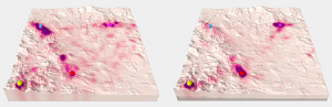 JEMR is an open-access journal devoted to all aspects of oculomotor functioning including methodology of eye recording, as well as its applications. JEMR has impact factor 0.568 and is indexed in WoS and Scopus databases.
11th International Conference 3D Geoinfo
20 to 21 October 2016; Athens, Greece
The 11th Annual Conference of the 3D GEOINFO conducted together with the 5th international workshop on FIG 3D cadastre and with the workshop Indoor 3D as 3D Joint Conference. The venue of the conference was Athens (Aegli Zappio). Carto4edu research team was represented by RNDr. Lukáš Herman and Mgr. Radim Stuchlík. Lukáš Herman gave a presentation entitled “Touch Interaction with 3D Geographical Visualization on the Web: Selected Technological and User Issues“. The same titled article was also published in the conference proceedings (ISPRS Archives).
Conference Social Processes & Personality
12 to 14 September 2016; Nový Smokovec, Slovakia
Conference Social processes & personality (SPAO) represents an annual meeting platform for Czech and Slovak scientists and students of psychology. Within conference we presented research poster entitled “Embodied Morality”, which summarized the research design of embodied moral acting and outlined the methodological aspects of the research. The experimental methodology of the moral dilemmas tasks in virtual, computer-simulated environments was introduced. Research team was represented by the author of the poster (Mgr. Vojtěch Juřík).
Annual Congress of the Czech Geographical Society
5 to 7 September 2016; České Budějovice, Czech Republic
CGS Annual Conference was held in early September in the České Budějovice and involved more than 140 participants. The program comprised of more than 110 contributions was divided into 25 sections. The research team Carto4edu was represented by Mgr. Bc. Zdeněk Stachoň, Ph.D. and doc. RNDr. Petr Kubíček, PhD., who introduced the issue of “User specifics of 3D visualizations,” which was included in section “Maps and their use”.
23rd ISPRS Congress
11 to 19 July 2016; Prague, Czech Republic
23rd Congress of ISPRS (International Society for Photogrammetry and Remote Sensing) was held 11 to 19 July 2016 in the Congress Center Prague and hosted 2,350 delegates from around the world. The research team Carto4edu was represented by Mgr. Bc. Zdeněk Stachoň, Ph.D. already on the pre-conference workshop named “Usability Methods and Eye Movement Analysis for Understanding the use of Remotely Sensed Imagery, Geovisualizations 3D and Virtual Reality”. Furthermore, there were orally and by the paper presented two contributions and one poster, which was included within the expert section “Perceptual and Cognitive Experiments with Imagery and 3D models“. The paper “Analysis of Visual Interpretation of Satellite Data” was presented by doc. PhDr. et Mgr. Hana Svatoňová, Ph.D. Further, RNDr. Lukáš Herman presented a paper entitled “Cognitive Aspects of Collaboration in 3D Virtual Environments“. Lukáš Herman also introduced the results of the partial research activities through a poster “Comparison of User Performance with Interactive and Static 3D Visualization — Pilot Study”.
International Conference EDULEARN16
3 to 6 July 2016; Barcelona, Spain
EDULEARN conference is an annual meeting platform for experts from various fields from all around the world. In 2016 the conference was held in Barcelona and the research team Carto4edu was represented by Mgr. Vojtěch Juřík, who introduced the results of their research activities. Lecture on “Learning in Virtual 3D Environments: All About Immersive 3D Interfaces” was included in the block “Virtual Reality and Augmented Learning” and the article was published in the conference proceedings. Both the lecture and the article were dealing with the human interaction with virtual environments regarding the specific UI settings.
International Conference Cognition and Artificial Life
1 to 3 June 2016; Telč, Czech Republic
Conference Cognition and Artificial Life is an annual event where experts from the fields of psychology, neuroscience, cognitive science and IT meet to share knowledge and to establish an interdisciplinary collaboration. Carto4edu project team was represented by Mgr. Vojtěch Juřík and Mgr. Čeněk Šašinka, Ph.D. Vojtěch Juřík presented the lecture and article entitled “When is more or less: The significance of human error when interacting with 3D virtual geographic environments”, where he introduced the impact of the specific UI settings on the decision-making as well as risks of 3D technology in the applied areas where humans interact with virtual geographic visualizations.
The meeting of the research team Carto4edu
May 30, 2016; Brno, Czech Republic
The second meeting of the research team Carto4edu project was held on May 30th 2016. The meeting was focused on the current research and experimental issues. It was negotiated excursion to a HCI laboratory at Faculty of Informatics. Also, there was evaluated the performance progress in individual tasks, which were specified at the introductory meeting.
90th Anniversary of the establishment of the Institute of Psychology FF MU
May 10, 2016, Brno, Czech Republic
On the occasion of 90th anniversary of the foundations of Institute of Psychology in Brno there was organized a micro-conference. The conference was held in the premises of the Faculty of Arts of Masaryk University in Brno and there were in a poster session also presented the first partial results of Carto4edu research activities. Poster was entitled “Is More Less? How 3D Visualization Affects Cognition”. Poster describes the experimental design and summarizes the partial results of the first survey on 3D geovisualisation presented in interactive virtual interfaces. The author of the poster was Mgr. Vojtěch Juřík.
AAG Annual Meeting
March 29 – April 2, 2016; San Francisco, USA
The annual meeting of the Association of American Geographers (Association of American Geographers – AAG) hosted in 2016 in San Francisco (California, USA) more than 7,000 scientists from around the world. Carto4edu project team was represented by Mgr. Bc. Zdeněk Stachoň, Ph.D. and doc. RNDr. Petr Kubíček, PhD. with the presentation “Interactive 3D Visualiation and Geospatial Data Depiction,” which was included in the section “Cognition, Visualization and User Issues, IV.”
Working meeting of research teams CEPCoS, HUME Lab and CEITEC
March 24, 2016; Brno, Czech Republic
Working meeting of research groups CEPCoS, HUME Lab and CEITEC aimed to outline the mutual cooperation between our research departments. The meeting was held in the premises of the Central European Institute of Technology in Brno and was held in English. There were presented two lectures related to the project Carto4edu. Presenters were Mgr. Vojtěch Juřík. The lecture “Embodied Morality” introduced experimental design that explores aspects of the human moral decisions in a computer-simulated virtual environments. In the lecture “3D Visualization of Geographical Data” was presented an introduction to the research of 3D virtual geovisualizations and were presented the first research outputs.
Introductory meeting of the research team Carto4edu
March 11, 2016; Brno, Czech Republic
Opening meeting of the research team Carto4edu was held on March 11 at the premises of the Faculty of Education. There were summarized the objectives and expected results of the project, addressed organizational matters (contacts, logo project, document sharing, character and appearance of the site, etc.), and presented researches that individual members of the research team began before the Carto4edu project started.